Tuesday, July 24, 2012

Swan Peak

A short 2 mile hike offering a beautiful unobstructed view of Bear Lake?
You bet!
On this day 10 friends made the hike with no regrets.
In fact, Swan Peak is considered one of our favs and we don't like to miss it.

Swan Peak offers an elevation of 9082 feet and is located north of the North Sink area.  Take the Swan Flat dirt road north (about two miles east of the Beaver Mt. turn off).  At this point there is about 3.8 mile drive to the trailhead.  Park in the trees on the west side of the road and begin following a distinct trail east of the road.
We had barely left our vehicles when almost immediately we were faced with the most strenuous part of the hike.  On this 0.5 mile stretch we gained about 650 feet.
We give credit to our "snack in the back" for this experience.  She suggested we keep going straight up the trail verses taking a more gentle trail that veered off to the right through the aspens.  Both trails lead to the top but we chose the difficult one and lived to tell about it. 
Thanks Teresa!
The trail eventually leveled off and we enjoyed easy to moderate hiking through the aspen and pine trees.
We sometimes see ant hills while on our hikes but never one of this magnitude.
We didn't stop to look for long, obviously. 
How an old box springs found its way to the mountainside was beyond us but
we didn't hesitate to try a jump or two.  After all we're all young at heart.
What is it about a fallen tree across the trail that shouts for a photo op?
We continued following the trail to the south in time taking an
indistinct path heading eastward up the mountain.
Suddenly there it was...
a beautiful panoramic view of Bear Lake.
It's no wonder Swan Peak is one of our favorite hikes.
A cairn marks the top of Swan Peak. 
Just below the cairn is a flat ledge with large rocks where we sat and admired the view.
Sunshine,
hiking,
 good friends,
majestic views,
 and
beautiful Bear Lake
always make this hike a huge success!
We also started a new tradition.
Yup, raspberry shakes at La Beau's.
{And just when we thought this hike couldn't get any better.}

Tuesday, July 3, 2012

Steam Mill Lake

This is a beautiful hike, about a 10 mile round trip, in the high mountains of Logan Canyon/Franklin Basin.  It starts out going through aspen and evergreen trees, climbing moderately. 

 It then opens up and levels out into meadows along a lovely stream.  

There are showy wild flowers along the way.

The trail and lake is named for the old steam mill that is still there, along the trail.  


A mile or so after the steam mill one comes to a small mountain lake which was our destination.

There are plenty of rocks and shade to sit and rest, eat lunch and take in the view.

This year was very dry as evidenced by the dry pond that you come upon just before you arrive at the lake (or just as you are leaving the lake.)  The following 2 pictures show the  pond this year and last year, which was a much wetter year.

It is a fun hike with lots of beautiful scenery.  As an added bonus there is a legend of buried treasure near the lake.  If you find the treasure, please share with the Likin' Hikin' Ladies.

If you come from Logan, you drive up Logan Canyon along hwy 89 for more than 20 miles until you come to Franklin Basin road.  This is a dirt road on the left.  Soon after you turn you'll drive past a parking area and then a bridge.  Right after the bridge there is a small road on the left.  Take it and then take one of the forks to the right.  This is a very bumpy, rocky road so if you're in a car drive cautiously.  Toward the mountain you'll see an open area, near a stream where people often camp.  You'll see several large boulders along a parking area and a sign.
This is where you start the hike.  There is a new bridge over the stream at the beginning of the hike.  The trail is well traveled and easy to follow.  It's a popular horse trail.  The only place where you may question which way to go is when you reach the steam mill.  There is a fork there.  Take the right fork, along the stream, which leads to the lake.  
Have fun!  We did.

Thursday, June 28, 2012

White Pine Lake Trail


If you go:
  • This is Hike #20 in Cache Trails by Jim Sinclair. 
  • Our GPS logged about eight miles (we had two different units with slightly different amounts) for the trail plus a little over a mile for the loop around Tony Grove Lake. 
  • The pedometer registered 20,760 steps for the whole thing. 
  • Elevation at start was 8,147 feet, maximum elevation was 8,787 with ascent of 1072 and descent of 1141. The lake lies lower than most of the trail, so the last bit into the lake is quite a drop. 
  • The parking at Tony Grove Lake costs $5.00 per car, so don't forget to bring a bit of cash. 

It's wildflower season!  We did this hike at the end of June.  Sometimes that time of year there is still a lot of snow, but not this year. As a result, we got to enjoy many of the early wildflowers like Nutall Violet:
Glacier Lily

As we climbed higher, there were lots of Glacier Lilies.  On one of our first hikes, we were so pleased to find and identify these lovely flowers. They only bloom in the early part of the year, usually next to melting snow, and at altitudes above 7,000 feet, so we consider them a rare treat each spring.  Here they are in the rocks and beside a stream.
Hydrophyllum capitatum, Ballhead Waterleaf has a name that describes it perfectly.
Unidentified PWF (Pretty White Flower)
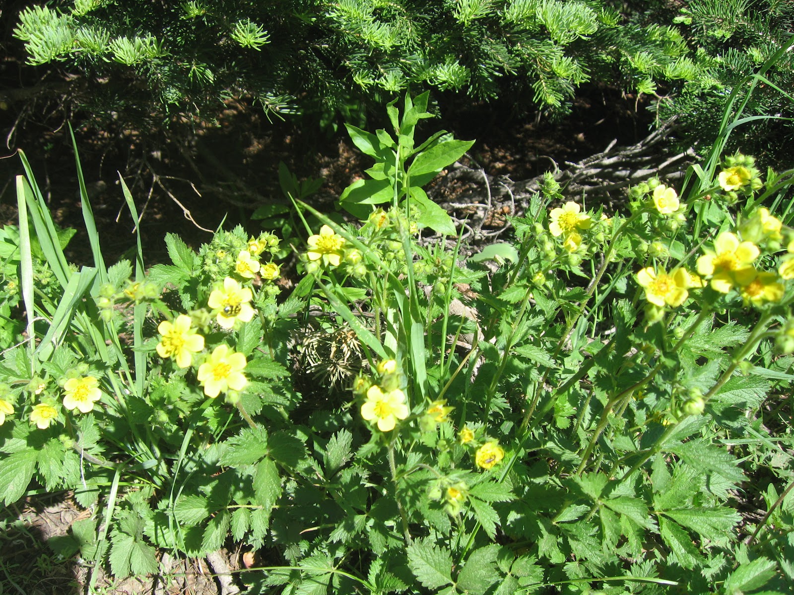
Cinquefoil
Cinquefoil and some lovely new growth on the evergreens.  Janet has a great speech about new life and new hope that she promised she would share with us if we posted some pictures of that beautiful new green.
This pretty leaf was in some cooler and wetter areas.  I believe it's Heuchera, but it's not blooming so I'm not certain.

Here's another unidentified one.  If someone wants to comment and let us know, we'd be pleased!  This one was very impressive with its bushy growth and slender leaf design.
The tiny white ones are Spring Beauty, and they bloom along with the Glacier Lilies as you can see in the photo.
This cutie is Hairy Clematis, which is always facing the ground, so that's why you get a sky background.
Forget-me-nots were plentiful on this hike.  We have a special connection this year to this tiny beauty.  Many of us are trying to remember the things that Elder Uchtdorf told us to "forget not" in his talk.

Even where the flowers weren't blooming yet, there was plenty of beauty to behold.

This tree fell in the forest.  The root system was massive.  We wondered if anyone was there to hear it?
Yes, there was a bit of snow on the trail, and we enjoyed a little play time, 
 including a snowball toss.

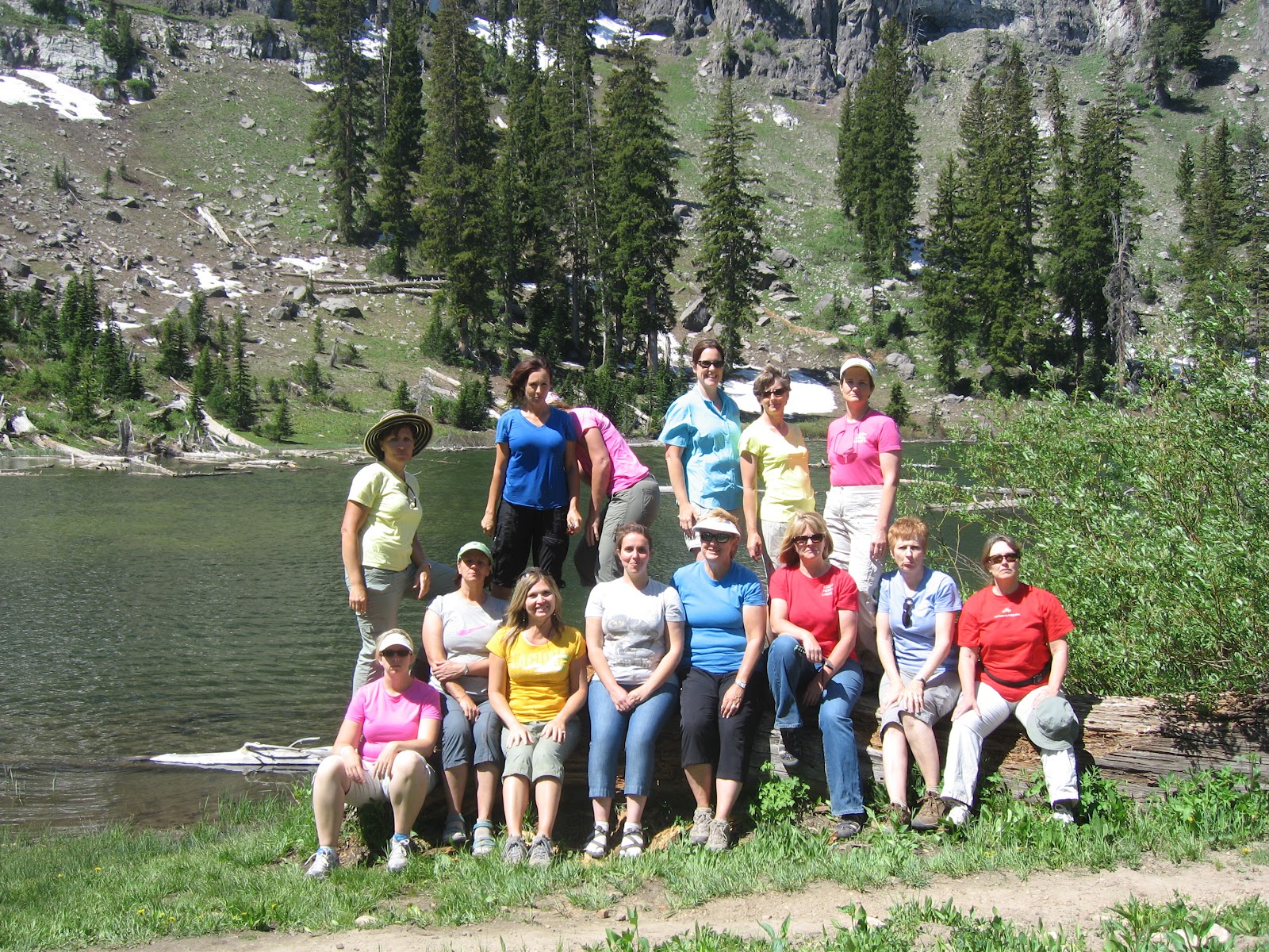
Fourteen of us reached White Pine Lake.  We like to take group shots and try to do something a bit different each time.  This time we were attempting to be serious with straight faces.  Some were better at it than others, but one person got laughing so hard she had to hide her face.


There were lovely streams running down into the lake.
 White Pine Lake is a small high mountain lake that must have fish in it because we sure did see a lot of fishermen.  It's very popular for overnight backpacking outings because there is a campground here.

On the way out, we met up with five dads each bringing little boys, a couple of scout troops and some other people.  White Pine Lake is definitely a trail worth trying out.


Tuesday, June 19, 2012

Old Ephraim's Grave

12 mile hike?  No problem.
{We're the Likin' Hikin' Ladies and we're tough.}
On this day 7 hiking friends made the trek to
Old Ephraim's Grave.
We logged 27,385 steps averaging 27 minutes per mile reaching an elevation of 7,318 feet.
The hike provided a moderately long loop (we won't talk about a steep dirt road!).
Our journey began off Right Hand Fork past Camp Lomia.  About 0.4 miles hiking along the creek we passed the mouth of Ricks Canyon which is also the end of the return route.  We continued on to Willow Creek trail.  From there we hiked through beautiful aspens, enjoyed beautiful flowers, and scenic views.
These fallen aspens reminded us of the game Pick-Up-Sticks.
Kathryn did a great Vanna White impression showing us the tree sculpture. 
We saw lots of butterflies of all colors and sizes along the trail.
The beautiful Sky Rocket flower.
Yellow Monkey Flower
In 1999 the Forest Service constructed a new trail off Willow Creek, called
Ephraim's Cut-Off,
providing a shorter route.  Apparently Jordanne and Laurie thought
this would be a great place to make faces at one another.

Speaking of Willow Creek...
Did you know the trail up Willow Creek was the original wagon road over to Bear Lake
before the present Logan Canyon road was developed?  Yep, it's true.
This big rock might be a sweet reminder for some of the Ladies
of a recent hike to
Willow Creek - Little Cottonwood. 
Does the word "Lost" ring a bell?
They should have turned left when they turned right. 
But never fear...
Our fearless leader, Nan, soon found them. 
Today we were all together and hiking in the right direction
The route eventually became a bit steep with several cairns marking the way as we gained elevation.
It takes a bit of creativity and a whole lot of energy to climb up here and build a cairn.
We were thankful someone did because they lead the way up a fairly steep incline.
In time we came to the sink hole of all sink holes, at least on our hikes.
It's hard to miss not only because of its size but the sink hole is immediately off to the left of the trail.
We have a favorite sink hole we snowshoe to in the winter and play in the snow.
This is NOT it!
However this impressive sink hole has a depth of 120 feet. 
No we did not measure the massive hole in the mountain but read about it later.
We were a little nervous to stand too close but we couldn't help but be
drawn to its size.  After tossing in a few rocks and taking pictures it was time to move on.
Nan never tires of pulling out the dreaded dyer's woad.
In fact, she has set a good example for us each to follow.
We would much  rather see the lovely Columbine flower and they were out in
abundance today.
Some of the ladies have phone apps that help us to identify distant mountain peaks.
Here we are looking off into the distance at the Naomi Peak area.
We could also see the tower on top of Mt. Logan peak.
There is so much to see and enjoy on our hikes. 
Is it any wonder why we love hiking so much.
At this point of the trail we descended the mountain entering into a small meadow.
We knew the monument was just ahead. 
 {Laurie used her handy dandy phone app notifying us of miles we had hiked.}
We were happy after hiking 6 miles to finally make it to the monument. 
We stopped to rest and
enjoy lunch while Nan shared the story of
Old Ephraim.  
We laughed at being the only ones at the monument and within minutes there was a crowd.
We didn't mind.  It's always fun to meet people and hear their stories.
Reaching our destination on most hikes means the difficult part is behind us.
Not so on this hike.
The most grueling part is the 1.8 mile dirt road immediately after leaving the monument.
It seems to go straight up in places.
Kathryn wasn't feeling well and we were able to hitch a ride for her on a 4-wheeler.
We were happy to meet up with our dear friend near this sign a short time later.
Both were a welcome sight!
At this point we turned west and began a pleasant descent of almost 3 miles back to the junction of
Ricks Canyon.
We couldn't pass a tree in distress without stopping to help.
A fallen aspen landed on this little pine tree bending it over. 
The ladies jumped to the rescue.
We're cool like that. 

Chalk this hike up to another day spent with great friends and great hiking!