Monday, November 19, 2012

November Hikes

Don't let the lack of posts fool you into thinking we've stopped hiking. No way! We've been busy alright enjoying our Fridays and spending time together. Here's a quick November update.

Our most recent hike, Nov. 16, was more of a 3 mile walk each way. We walked the North Logan Canal Trail to Sharon's house. Once there, we enjoyed hot chocolate with yummy cookies and brownies. Sharon has a beautiful home and we loved spending time there. In fact, we almost spent more time sitting around her kitchen counter chatting than we actually did walking. None of us seemed to mind however. We are definitely making this adventure a tradition! It's perfect for those days when it's too muddy to hike in the mountains and yet there's not enough snow to snowshoe.
Speaking of snow...
 Friday, November 9, was our first cold snowy day. But the snow doesn't scare us. We decided it was a perfect day to walk the River Trail. And walk it we did. We may have been a little cold and slightly wet but, we didn't mind. 
Not all the ladies could join us this day but, those who did had a great time.
See that white stuff on the mountain? Yep, we love the first snow fall.
We love ALL the snow that falls. It means snowshoeing is coming soon!
On November 2, we hiked Leatham Hollow.
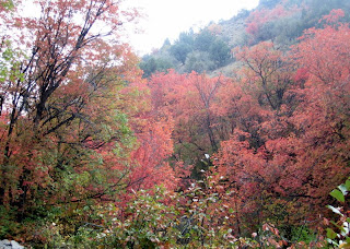
It was a nice hike with gentle climbing in mild November temperatures. Most of the leaves had fallen, the colors subdued but there was still much beauty to be found.
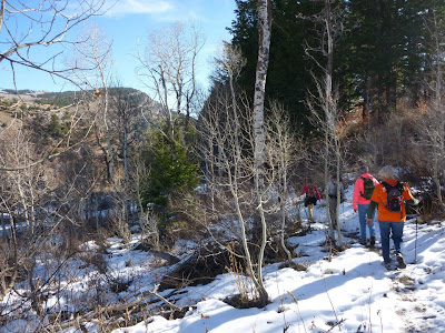
We encountered snow in the upper elevations.
We stopped for a rest in what might be the creek bed for next spring. 
This shows the nice trail and gentle climb that we enjoyed for at least half of the hike. 
Looking down Leatham Hollow and, in the distance, Blacksmith Fork Canyon. If you look carefully you can see the window reflection of one of our cars parked at the trail head.
Here is the destination, the other end of Leatham trail near the top of Millville Canyon.

Friday, October 19, 2012

Temple Fork Sawmill

The Temple Fork Sawmill hike has always been, and will always be, one of our favorite hikes.
 
When our group began hiking over 4 summers ago this was one of our first hikes.
We have loved it since!
In fact, it was on a Temple Fork hike in which a great idea was born. The idea began with a photo taken of our hiking shoes. We all stood in a circle and someone snapped a photo while we looked down at our feet. The image from the photo is now fabulously placed on the back of our Likin Hikin t-shirts. Who says hikers aren't creative? Probably no one. But we like to think we are either way.
 
 On this day there were 16 hikers who made the trek to the Temple Fork Sawmill site.
We have more fun than should legally be allowed! We also use the word "trek" lightly because this hike is easy peasy and not much of a trek at all.
Many photos have been taken on this bridge of the Likin Hikin Ladies.
LuWana and Nancy were the first to arrive on this day. Check out those victory grins!
This bridge is located about 1.5 miles into the hike and is located right of the trail.
Once past the bridge the trail follows along beautiful Spawn Creek.
 Both trail and creek wind their way through the stands of aspen and cottonwood.
Fall, summer, spring, or winter, this trail is beautiful in all seasons.
The beaver dams are said to be abandoned but we don't believe it. There are always
changes in the dam formations and evidence of beaver markings on the trees. 
The beaver dams
are intriguing to us as they show how busy those beavers really are!

The trail comes to an end at the Temple Sawmill site. We have taken many photos of the site but unfortunately not today.  There is a small monument and a few artifacts that provide a little history of the mill and the wood used to help build the Logan Temple. 
 
If you go: The hike is a distance of 2.75 miles and is rated easy. The starting elevation is 6000 feet with a change at only 675 feet. Temple Fork road is located 15.2 miles up Logan Canyon. Turn right and cross the Logan River on a bridge.  Immediately to the right will be a parking lot but the Temple Fork Road is suitable for cars for another 5 miles.  We often walk this road if the gate is closed however. There is parking and a restroom available near the trailhead. The trailhead is located south, right of the berm.

Thursday, October 11, 2012

Willow Creek / Maughan Hollow

Our hike to Willow Creek / Maughan Hollow brought out all the colors of the rainbow.
This hike is a favorite that we enjoy hiking and snowshoeing.
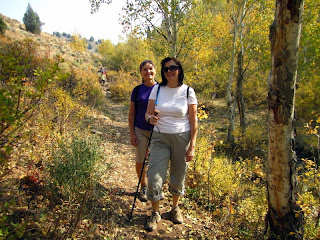
On this beautiful fall day 19 ladies wearing various colors showed up to spend a few hours with hiking friends in the mountains.  This was our largest hiking group to date. 
Our line of ladies kept coming and coming.
We didn't stop to rest on this hike. 
We stopped to take in all the beautiful colors.
Autumn has arrived and the vibrant colors were all around us.  Each season brings beauty to the mountains but nothing compares to fall in our beautiful canyon.
The fall colors were true to Logan Canyon style.  
Colors of vibrant red and yellow dot the mountain side.
We were more than happy to welcome back Tracii, one of the original hiking ladies.  She surprised us when she showed up after being gone for almost a year or more.  We couldn't help but shower her with hugs and smiles.  Work had taken her away for a while but we hope she's back to stay!  She is, after all, the one who taught us our theme song, "Fridays" and she is also responsible for naming a certain flower which we will not mention here. 
Welcome back hiking friend!
The hiking ladies are pictured at the high point of the hike. 
The photo doesn't show the fall colors too well but, you get the point.
From here we hiked down through a small canyon area full of more beautiful fall colors.
All too soon the hike ended and it was time to go home.
One problem...
we still had visiting to do and no one seemed to be in a hurry to leave.

We picked an easy 4 mile hike and the ladies showed up en masse.  
The general consensus was the colors were at peak today and we were all thankful
to have enjoyed them.

If you go:  Drive 9.5 miles up Logan Canyon to the Right Hand Fork turn off.  Turn right on a paved road heading east.  In 1.6 miles you will see Lomia Girls Camp.  However, stay left on the gravel road for 0.6 miles to Right Hand Fork trailhead and parking area.  Starting elevation is 5520 feet.  Hike east through a shady riparian corridor and in about 0.4 miles you will pass the mouth of Ricks Canyon on the right.  The Maughan Hollow trail forks off the Willow Creek Trail to the left after passing the fork to Ricks Canyon.  The trail will lead to a big switchback once leaving the Willow Creek trail at the bend.  A faint trail then leads to an open area of aspen groves and meadows.  The high point of the hike is 6520 feet.  The trail continues down through a moderately steep grade in a narrow part of the canyon. This hike is rated easy.

Friday, September 14, 2012

Crimson Trail September 12, 2012

Crimson Trail has been a favorite trail in Logan Canyon for generations.  This beautiful fall day brought out quite a crowd.  We even had out of town visitors.  It was a typical Autumn morning and a bit chilly so jackets were in order, but as with most hikes, once we got moving, we warmed up just fine.
 We took the Riverside Trail from Spring Hollow toward Guinevah Campground.  It is an easy walk and we did the first mile in about 28 minutes.  Soon we found the Y in the trail and took a right turn which headed up the mountain. 

 There are switchbacks up this mountain as you climb about a thousand feet.
 It's good to stop and take rests along this part of the trail.  The ascent is very steep.

 We all appreciated a break to stop and breathe, and tried to find level places to do that.
 Finally we came to the last steep spot going up to the top.  Can you see two people in the background laboring up that hill?  The last time the Likin' Hikin' Ladies did this trail, there was snow in this spot.  It was slick and difficult!  We were glad it was dry today.
We decided that anyone can climb a mountain if you just take it one step at a time and can do it at your own pace.  It reminded us of Shel Silverstein's poem from Where the Sidewalk Ends:
 
Melinda Mae

Have you heard of tiny Melinda Mae,
Who ate a monstrous whale?
She thought she could,
She said she would,
So she started in right at the tail.

And everyone said, “You’re much too small,”
But that didn’t bother Melinda at all.
She took little bites and she chewed very slow,
Just like a good girl should . . .

And in eighty-nine years she ate that whale
Because she said she would!


 When you reach the top, you walk along the "China Wall."  It's not a good hike for those with a fear of heights.

 This rock jutting out is always a good photo op, but nobody wants to go too close to the edge.

 It's a long way down.

The fall colors were just beginning and made it a lovely hike.


 Our friend Sharon always has a good yoga pose to show and it's really impressive when you're this high in the air.
 The view across the canyon is impressive. You can see the matching "China Wall" on the other side.  It's about the same height as where we are.
 And the views down into the canyon, including the river and the road, are unmatched.
 It was fun walking through the lovely trees up on top.

 After heading down the switchbacks, we came out on the upper Spring Hollow Road.  The spring starts here and is very lush and green.

 We have been unable to do this hike for about a year while this new bridge has been built.  It looks, and even smells new.  We were glad to see it.
 This lovely waterfall is a slight detour from the road, but is always worth a look. 


If you go:  This is a 4.73 mile hike if you park at Spring Hollow, travel up the river trail and then onto Crimson Trail and back to Spring Hollow. Crimson Trail has a total ascent of 1,292.65 ft and has a maximum elevation of 6,354.99 ft.  It took us just under three hours.  Drive up Logan Canyon, watch for the signs for Spring Hollow Campground.  Park in the parking area before the gate and follow the signs for the Riverside Nature Trail. 

Tuesday, September 11, 2012

Bunch Grass to White Pine

Today's hike was a first for our group of ladies.
We hiked the Bunch Grass Creek trail to White Pine Lake. 
The total miles hiked was around 11 miles. 
On previous hikes we have arrived at this sign hiking from Tony Grove.  We always would look to the north wondering what the White Pine-Bunch Grass trail experience would be like.  We have wanted to find out and today we did just that.  
We began our hike at Bunch Grass where we often snowshoe in the winter.
Once Nan, DiLynn, and Linda dropped off a vehicle at Tony Grove, our final destination, and caught up with the rest of us, we had a group of 14 hikers. 
The trail was hot and dusty as we started out.
We didn't see many wildflowers along the trail
and discussed hiking it earlier next year in order to see more of them.
We noticed how dry the canyon is this time of year due to a hot and dry summer.
It was refreshing to find this stream along the trail after hiking through sagebrush.  At this point the surrounding area became a little more pretty and green as well.

It seems we always find a bridge or two to cross while on our hikes.
In time we could see Mt. Magog.  Or is it Gog? 
These 4 plus 2 more had to head back early. 
Our hikes are addicting and we take what we can get even when life makes
 other demands on our Fridays.  Sharon would be riding in the Lotoja the next day and we wished her well.
The rest of the group headed into this large glacial basin. 
It was fun to hike through the beautiful open area as we headed toward White Pine Lake.
We were not too impressed with Goring pond. 
 It's much more pleasing in the winter when we snowshoe there.
There seemed to be several cows on the trail with us today as well.
(Not so pleasing)
The trail began to take us south up towards White Pine Lake.
We knew we were within a couple of miles at this point.
As we looked down from the trail we enjoyed seeing 
two small waterfalls not far from one another.  Very pretty.
And finally there it was, our familiar White Pine Lake sign.
It felt as if we were on our home turf.
Another 0.6 miles and we reached the lake.
Margaret and LuWana were especially excited to see the Lake. 
Neither one of them had been here for many years.
At White Pine we found a place to sit in the shade of the trees near the lake and enjoy lunch.
We talked about previous experiences of hiking to White Pine and listened to Nancy B.'s story of
being here years ago during a storm with her sons.  She never cared to come back.
We think today was a much more positive experience for her.  A few of us shared the experience
of backpacking in during the first weekend of August a couple of years ago.  We got caught in a snowstorm and loved it.
This newly half built ridge is not far from the lake and has been under construction
since last year.  We wondered if would ever be completed but appreciated the work done on it so far.
From the switchbacks leaving the lake we looked back at where we had been.
It's hard to see from this photo but standing on the trail we could see across the valley at the
trail we had hiked winding its way through the mountain to White Pine.
11 miles later and with tired feet we found our way to the Tony Grove area with one vehicle waiting.  These happy volunteers took a ride in the back of the truck down to the Bunch Grass trail head where other vehicles awaited us.
We enjoyed another great Friday spent in the mountains enjoying another great hike with good friends.
 
If you go:  the trailhead is located about 20 miles up Logan Canyon near mile marker 481.  The parking area is located on the right side of the highway 0.5 mile past the Tony Grove turn off.  The trail begins across the road 100 yards south of the parking area.  Hike is considered easy to moderate.  Trail will lead to White Pine Lake area junction.  From there trail continues on to Tony Grove area if desired.  Continuing to Tony Grove will require leaving a vehicle for transport back to Bunch Grass trailhead.  Total hike of 11 miles from Bunch Grass to Tony Grove.